Activity Bank
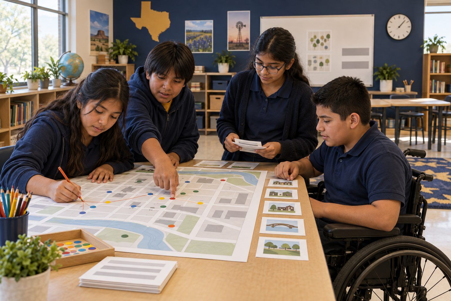
Middle school students connect location clues into a trail on a printed town map.

All activities Student learning

What Your Map App Knows

Students plot a fictional teen's Saturday from location clues on a town map, discover how much a trail of pings reveals, weigh safety against privacy, and write a location settings checkup plan.

Print handouts

Overview

Phones, games, cameras, and friend-finder apps can record where we are, often without us thinking about it. In this unplugged simulation, teams receive twelve location clues from one Saturday in the life of Dani, a fictional seventh grader in the fictional town of Juniper Falls: map app pings, a geotagged photo, a check-in, a live location share. Teams plot the trail on a printed town grid and discover that a handful of dots reveals where Dani lives, who Dani hangs out with, and where Dani will probably be next Saturday. Then students weigh when sharing location keeps people safe and when it puts them at risk, and write a step-by-step checkup plan for their own device settings.

Objectives

  • Students will plot location clues from several sources and infer at least three things the trail reveals (home area, routine, companions, likely future location).
  • Students will identify at least three ways location data gets created: GPS in apps, location sharing, geotagged photos, check-ins, and location history.
  • Students will explain a trade-off between safety and privacy for a location-sharing decision and defend a choice.
  • Students will write a systematic, step-by-step location settings checkup plan they can complete with a family member.

Materials

On paper

  • Handout A: Juniper Falls Town Grid (1 per team, enlarged to 11 x 17 if possible)
  • Handout B: Dani's Saturday Location Clues (1 set of 12 cards per team, cut apart, shuffled)
  • Handout C: My Location Settings Checkup Plan (1 per student)
  • Colored pencils or markers; small sticky dots or numbered sticky notes
  • Four corner signs: SHARE IT, SHARE FOR NOW, ONLY WITH FAMILY, KEEP IT OFF

On screen

  • Optional: the teacher's own phone or tablet, projected, to show where location settings live (no student devices required)
  • Optional: a shared digital map or drawing tool where teams drop pins on a blank fictional town map

Before you start

  1. Print Handout A for each team, ideally enlarged. Print and cut Handout B into 12 cards per team; shuffle so the times are out of order.
  2. Post the four corner signs around the room for the trade-offs round.
  3. Read the card backs so you can steer teams toward inferences without giving them away.
  4. If you plan the optional demo, find your own device's location settings, per-app location permissions, and photo location option ahead of time. Turn off anything that would show your real home or routine before projecting.

Step by step

  1. 10–5 min

    Hook

    Three dots

    Draw three dots on the board and label them Mon 7:30 AM, Mon 3:45 PM, Mon 9:00 PM. Say: "Imagine these are three places a phone was on Monday. What could you guess about the person?" Students will quickly say: school in the morning, practice or a friend's house after school, home at night. Say: "Three dots, and you already know a lot. Today you'll get twelve."

    Facilitator noteKeep the Hook abstract. Do not invite students to share their own routes or addresses.

  2. 25–17 min

    Explore

    Plot Dani's Saturday

    Teams get Handout A and a shuffled set of Handout B cards. Their job: put the clues in time order, plot each one on the grid with a numbered dot, and connect the dots into a trail. Next to each dot, they write the source of the clue (map app, photo, check-in, live share, location history, game). Then they answer on the back of the grid: Where does Dani probably live? Who is Dani with? What is Dani's routine? Where will Dani probably be next Saturday at 10 AM?

    Facilitator noteCirculate and ask, "Which single card gave away the most?" Teams usually pick the geotagged photo or the 11 PM ping in the home area.

  3. 317–23 min

    Debrief

    What the trail reveals

    Each team reports one inference and the clue behind it. Build a list on the board with two columns: What the trail showed and Where the data came from. Then name the big idea: "No single clue said 'Dani lives on Oak Court.' The pattern said it. Location data becomes powerful when it's collected over time and combined." Point out that Dani chose some clues (the check-in, the photo post) and never noticed others (location history, the game).

    Facilitator noteStay accurate and avoid fear. Location features are useful and often switched on for good reasons. The skill is knowing what's on and deciding on purpose.

  4. 423–31 min

    Practice

    Four corners: safety vs. privacy

    Read each scenario aloud. Students walk to the corner that matches their choice: SHARE IT, SHARE FOR NOW, ONLY WITH FAMILY, KEEP IT OFF. Ask one student per corner to give a reason. Scenarios: (1) Your family wants to see your location when you walk home from school. (2) A new game asks for your location "always," even when you're not playing. (3) You post a photo from your backyard and the photo still has location info attached. (4) A friend you met in an online game asks you to turn on friend-finder so you can "meet up sometime." (5) You're at a big, crowded festival with your cousin and could share location with each other until you leave. (6) A weather app asks for your precise location.

    Facilitator noteModel that thoughtful people disagree on some of these (1, 5, 6), and that others have a clear safest answer (2, 3, 4). Scenario 4 needs a firm, calm message: an online-only friend never gets your location; tell a trusted adult.

  5. 531–41 min

    Create

    My checkup plan

    Students complete Handout C, a step-by-step plan they can do with a family member: which settings to check, in what order, and what they'll decide for each. Push for a system, not a list of worries: Step 1: find the main location setting. Step 2: go app by app. Step 3: check who you share live location with. Step 4: check the camera's location option. Step 5: look at location history. Step 6: set a date to check again. Students also write one location choice they'll keep on because it keeps them safe, and why.

    Facilitator noteStudents without a phone can plan for a family device, a tablet, or a game console. Everyone can do this plan.

  6. 641–45 min

    Reflect

    Exit ticket

    On a sticky note, students finish: "Before I share my location, I will ask myself..." Collect notes on the door on the way out and read a few aloud next class.

    Facilitator noteStrong answers name a person (Who can see this?), a time (For how long?), and a purpose (Why does this app need it?).

Paper or screen

Unplugged

The full lesson is designed to run with no devices: the printed town grid, the clue cards, colored pencils, and the four corners. For a bigger, moving version, tape a large Juniper Falls grid on the floor with masking tape and have one student per team walk Dani's route while teammates call out the clues in order.

Digital

Teams can plot the clues by dropping numbered pins on a blank fictional town map in a shared drawing or slide tool, which makes the trail easy to compare across teams on the projector. For the checkup plan, project your own device (with anything identifying turned off) and walk through where the main location setting, per-app permissions (often choices like "never," "while using the app," and "always"), precise vs. approximate location, photo location, and location history usually live. Students do not need their own devices or accounts; they take the plan home.

Does it need a screen? This one is stronger unplugged: plotting clues by hand makes students do the inferring themselves, which is exactly what makes location trails powerful. A short teacher-led settings tour adds what paper cannot, showing that these controls are real, findable, and changeable.

Evidence of learning

What you should be able to see or collect if it worked.

  • Teams infer Dani's home area, companion, and likely Saturday routine and point to the specific clues that support each inference.
  • Students name at least three different sources of location data, including ones Dani did not choose on purpose (location history, a game running in the background).
  • In four corners, students give reasons that weigh who can see the location, for how long, and why, not just "it's creepy" or "it's fine."
  • Checkup plans are step-by-step and specific, include a date to check again, and name at least one location choice kept on for safety.

Adaptations

Grades 9–12
Add a card about a fitness or run-tracking app that shares routes publicly by default, and have students write a short argument about whether apps should default to location off.
Grade 6 or first-time learners
Give teams the clue cards already in time order and have them focus on plotting and on the four questions.
Emergent bilinguals
Add icons to each clue source (camera, map pin, people, game controller) and pre-teach "location," "share," "history," and "setting" with a visual word wall.
Students with motor or mobility needs
Replace walking to corners with holding up one of four colored cards; let a teammate place dots while the student directs.

Standards connections

Students infer what a trail of location data reveals and plan a step-by-step device settings checkup, the privacy-and-security substrand.

TEKS
privacy, safety, and security (c)(10)TEKS sections: Technology Applications §126.17–§126.19
UDL 3.0
3.27.26.2

See how all activities align

Reflect

  • Do I know what my devices share about where I am, and do I choose it on purpose? (Student ELE 2.0)
  • When does sharing my location keep me safer, and when could it put me at risk?
  • How did working through the clues step by step help us see a pattern that one clue alone could not show? (Student ELE 5.0)

What comes next

At home, students complete their checkup plan with a family member on one device and bring back one decision they made together (no screenshots or locations needed). Next lesson, connect to Data Trail Audit or What Do My Apps Know? to look at the other kinds of data apps collect.

Pairs well with